windows // // Tools & Utilities // //
Photo Album GPS Mapping Tool
Photo Album GPS Mapping Tool
Free Download Photo Album GPS Mapping Tool full version standalone offline installer for Windows. This tool is designed to parse the GPS coordinates extracted from the images' metadata.
Overview of Photo Album GPS Mapping Tool
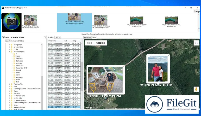
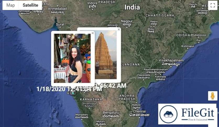
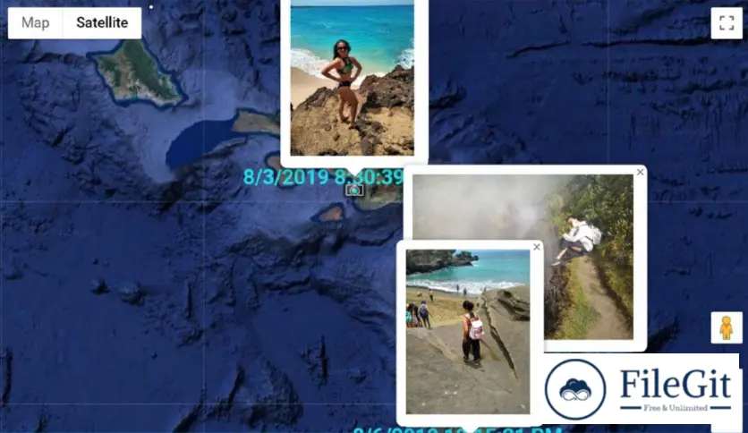
It organizes your photos in three separate ways. A timeline view allows you to see your photos chronologically. The Device View organizes the files by the device that took the photo, and a thumbnail view allows you to view the photos visually. Clicking on any view will generate a map for that photo. Multiple photos can also be selected to generate a map with multiple location points. Once the map is generated, click on the placemarks to see the photo on the map.
Features of Photo Album GPS Mapping Tool
- This is straightforward to use, even for beginners. The software has a user-friendly interface that makes it easy to navigate
- The tool uses GPS data embedded in your images to map where your pictures were taken. You can then use this map to organize your pictures based on location
- The software allows you to add geo-tags to your images, making it easier to find them based on location
- You can search for images based on location. For example, you can search for all images taken in a particular city or country
- The software automatically organizes your images based on location. This means that you can quickly find all images taken in a specific place or during a particular trip
Technical Details and System Requirements
- Supported OS: Windows 11, Windows 10, Windows 8.1, Windows 7
- RAM (Memory): 2 GB RAM (4 GB recommended)
- Free Hard Disk Space: 400 MB or more
FAQs
Q: What image formats does the software support?
A: The software supports various image formats, including JPEG, BMP, GIF, PNG, and TIFF.
Q: How does the software organize my images?
A: The software uses GPS data embedded in your images to map where your pictures were taken. It then organizes your images based on location.
Q: Can I add geo-tags to my images?
A: You can add geo-tags to your images using the software.
Previous version
File Name: Photo Album GPS Mapping Tool 2.8.4.777
Version: 2.8.4.777
File Information
| File Name | Photo Album GPS Mapping Tool 2.8.4.777 |
| Created By | Reverse Engineering Consultants |
| License Type | full_version |
| version | 2.8.4.777 |
| Uploaded By | Sonx |
| Languages | English |
| Total Downloads | 0 |
Previous version
File Name: Photo Album GPS Mapping Tool 2.8.4.777
Version: 2.8.4.777